Schedule
# JR Tokyo station-Parking lot (via Kanetsu expressway, 2hrs 23min (148km) by rental car
Record
Time: 3.9km(2hr20min);
Start elevation:1053m(Parking lot)
Highest point 1391m
Elevation gain 338m
GPS (Parking lot) 36°28'18.14" N 138°52'38.47" E
Mt. Haruna is the large size volcano and consisted of the 14 peaks, and has the famous 'Ikaho Onsen' hot spring at the base of the mountain.
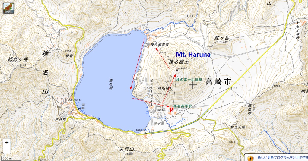
There is a good trail to go around Mt. Haruna-fuji from the ropeway station.
You may start from the south side gate of the trail, then go up to the top with the good trail.
From the top, you may see many mountains like Mt. Fuji, Mt. Yatsugatake, Mt. Akagi, Mt. Asama, Mt. Kusatsu-Shirane and Mt. Tanigawa...
The trail down to the North is steep and you need to be carefull to walk down.
After go down to the North, you may have a nice trail to the South along the Haruna lake.
In November, you can see nice autumn colored leaves.
http://www.city.takasaki.gunma.jp/kankou/nature/harunako.html
At the south base of the Mt. Haruna, there is the 'Haruna shrine' which id very old since BC900.
http://www.haruna.or.jp/?p=1314
Ikaho onsen town, Mt. Akagi (1828m), Mt. Shirane(2578m) Mt. Jyunigatake (1201m) and Mt. Hotaka (2158m) Ropeway to the peak
At the peak of Mt. Harunafuji Mt. Fuji (3776m) and Oku-chichibu mountains Yatsugatake mountains
Mt. Asama (2568m) and Haruna lake Haruna lake onsen (hot spring) Mt. Kamongatake (1449m)
Colored leaves Nice trail The gate of Haruna shrine
Misuzuno taki (water-fall) Haiden building Erosion control dam with height of 17m (1955)

Back