Schedule
# JR Okayama station-Kami-hiruzen Tozanguchi parking lot, 1hrs45min (115km) by rental car
Record
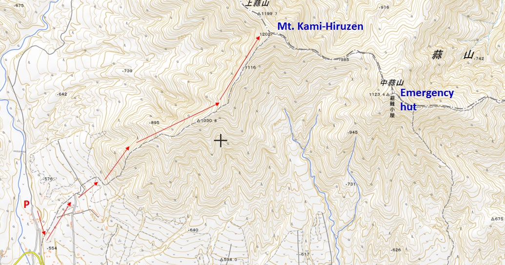
Time: 7.0km(3hr40min)
Start elevation:546m(Parking lot)
Highest point 1202m
Elevation gain 656m
GPS (Parking lot) 35°18'33.23" N 133°38'21.21" E
Mt. Hiruzen is located at the border of Tottori pref. and Okayama pref. in the western Japan.
Start point is in the Okayama pref side parking lot.
It was the autumn season (30 Oct. 2020) when I have visited to Mt. Hiruzen.
All the trees are changing the leaf's color from green to red or yellow and it was so beautiful.
Up to the second post, you need to go up with long stairs. After the fifth post, you may enjoy nice view of Hiruzen highlands. At the eighth post, you will see the summit of Mt. Hiruzen and also Mt. Daisen (Japan 100 mountains) at the west side.
From the peak, you may see the Japan sea, and Kurayoshi city and Togo lake in Tottori pref. at the north side.
http://ww81.tiki.ne.jp/~hiruzen/sp/index.html
Kami-hiruzen Parking lot 15min walk to the gate of trail Cedar forest at the second post
Mt. Daisen (1729m) at eighth post Colored tree and leaves
Peak of Mt. Hiruzen (1202m) Togo-lake and Kurayoshi city Mt. Nakahiruzen (1123m) and Mt. Simohiruzen (1100m)
Peak from eighth post Hiruzen highland Mt. Minagasen (1159m)
From Hiruzen highland From Hiruzen SA (Yonago Express way) Mt. Daisen

Back